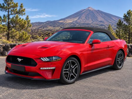
Most volcanic landscapes ask you to walk into them. Teide National Park lets you drive through the middle of one. The road crosses the floor of a caldera roughly sixteen kilometres across, past lava flows, pumice fields and eroded rock towers, with the highest mountain in Spain standing over the whole scene. It is a half day that feels like leaving the island entirely, and with an open roof you get the scale of it properly.
Las Canadas: the caldera floor
Las Canadas del Teide is the broad depression that surrounds the base of the volcano, sitting at roughly two thousand metres. Driving onto it is abrupt: the pine forest thins, the last trees fall away, and the land opens into a plain of ochre, rust and grey that runs to a rim of eroded cliffs. The colours change with the hour, deepening in the afternoon and turning almost red near sunset.
The surfaces here tell the story of different eruptions. Smooth pale pumice in one stretch, jagged black lava in the next, then long slopes of fine volcanic gravel. The Llano de Ucanca, a flat sedimentary plain ringed by rock, is one of the most photographed sections and one of the easiest to reach, since the road runs straight past it.
The park was recognised as a UNESCO World Heritage Site, and the protection is visible in how carefully the landscape has been kept. There is very little built here: a visitor centre, a parador, the cable car base station, and otherwise the road and marked stopping places. That restraint is precisely what makes the drive feel remote despite the number of people who come.
Roques de Garcia and the classic stops
Roques de Garcia is the obvious anchor of any visit. A line of weathered rock formations rises from the caldera floor, the remains of older structures eroded into towers and fins. The best known is Roque Cinchado, the improbably balanced pillar that appears on countless photographs of the island, with Teide framed behind it. There is a car park directly opposite and a circular walking trail for those who want more than the roadside view.
Beyond that, the pleasure is in the smaller stops. Miradores are marked at intervals along the road, and each frames a different combination of lava field, rim and peak. The mirador just above Llano de Ucanca gives the widest sense of the plain. Others look back down the southern slope towards the coast, with the sea visible far below and the cloud layer usually somewhere in between.
If you have any interest in the night sky, note the observatories on the ridge at Izana as you pass. The clarity and altitude here make this one of the better places in the world for astronomy, and the same conditions make the park exceptional for stargazing. Evening visits are a genuinely different experience from daytime ones, though they require warm clothing and a plan for the descent in the dark.
The half-day driving loop
The cleanest route is a traverse rather than an out-and-back. Come up from one side of the island, cross the park from east to west, and descend the other side. From the north that means climbing through the Orotava valley on the TF-21, crossing the caldera, and dropping south towards Vilaflor and the sunshine. From the south you simply reverse it. Either way you finish somewhere entirely different from where you started, which is the point.
Budget four to five hours as a minimum if you want to stop properly, and more if the cable car is part of the plan. The driving distance is modest but the pace is slow, the stops are frequent, and the road demands attention. Adding the Esperanza forest road, the TF-24, on one leg turns it into a full day and gives you an entirely different landscape on the approach.
Fill the tank before you climb. There is no fuel inside the park, and the combination of altitude, distance and a route that discourages hurrying uses more than people expect. Bring water and something to eat as well, since options up top are limited and often busy.
Rules, altitude and weather
This is a national park, and the rules are enforced. Stay on marked paths and designated parking areas, do not remove rocks or volcanic material, and leave nothing behind. Drones require authorisation. Reaching the final summit crater on foot needs a permit booked in advance, with limited daily places, so it has to be arranged before you travel rather than on the day. Since 19 January 2026 the summit trail (No. 10, Telesforo Bravo) is paid between 9:00 and 17:00: €15 for visitors from outside the Canary Islands, €6 for residents of the other Canary Islands, free for Tenerife residents and children under 14 (Cabildo de Tenerife).
Altitude changes how the day feels. The air is thin and dry, the sun is stronger than at sea level, and the temperature is far lower than on the coast. Wind on the plateau can be sharp even when the coast is still. Take a real jacket rather than a light layer, drink more water than you think you need, and expect to feel the elevation if you walk any distance.
Weather deserves the last word. Snow falls in winter and can close the access roads at short notice, sometimes for days. High winds close the cable car regularly. Conditions on the mountain are frequently nothing like those at your hotel, so check before setting out, and treat any closure as final rather than negotiable. On the days it is open and clear, there is nowhere on the island quite like it.